Weather Images created by WeatherWX.com
Published July 22, 2021
By Meteorologist Mark Baldwin –
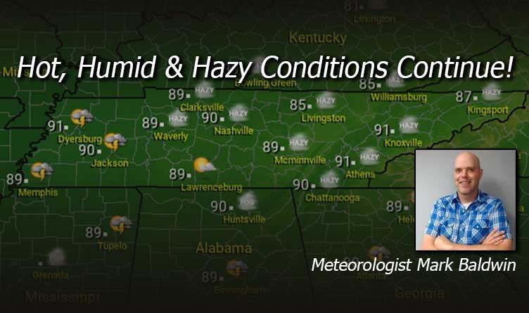
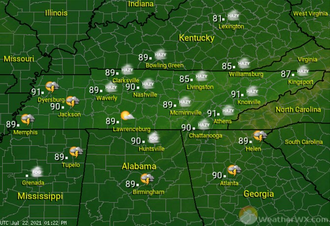
Look for hazy, hot, and humid conditions today. An old frontal boundary will drift northward and produce scattered afternoon and evening thunderstorms across southern West Tennessee, including the Memphis and Jackson areas. The rest of us will just be hot and hazy. Afternoon highs will approach or even touch 90 degrees for most today, though the humidity will make it feel much hotter. Keep in mind that air quality alerts are active once again for the Nashville area today. Limit outdoor activities if you have respiratory issues.
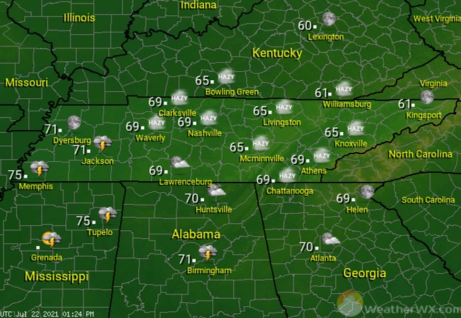
Evening storms will dissipate across southern West Tennessee after sunset. Statewide, skies will be hazy and the air will be humid. That warm and humid air will keep overnight low temps in the mid to upper 60s for most.
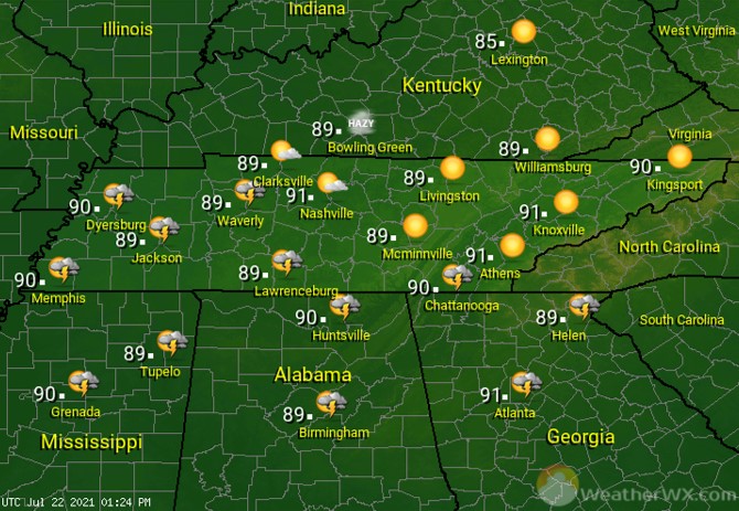
Most of us stay dry, hot, and humid for our Friday. A few afternoon and evening storms will likely develop across Western and southern portions of the state. Otherwise, look for partly to mostly sunny skies and high temps around 90 degrees. Keep in mind that humidity will make it feel much warmer, so be safe in the heat.
Visit Meteorologist Mark Baldwin on Twitter, Facebook and at meteorologistmark.com.