Weather Images created by WeatherWX.com
Published April 23, 2021
By Meteorologist Mark Baldwin –
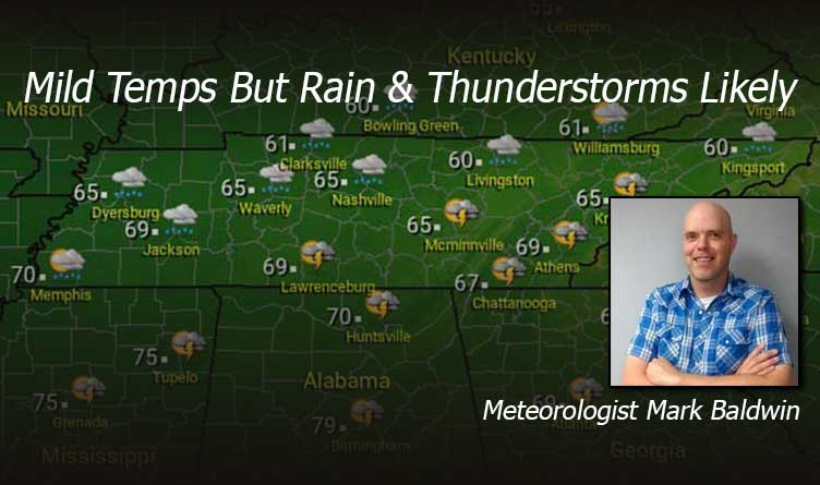
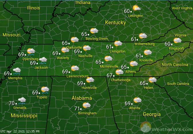
Skies will be cloudy today, ahead of our next storm system. That system will begin spreading showers across the state from the west today. It’s a milder April day from what we’ve seen over the past couple of days, with highs in the 60s for West and Middle Tennessee, and near 60 degrees for the plateau and much of East Tennessee.
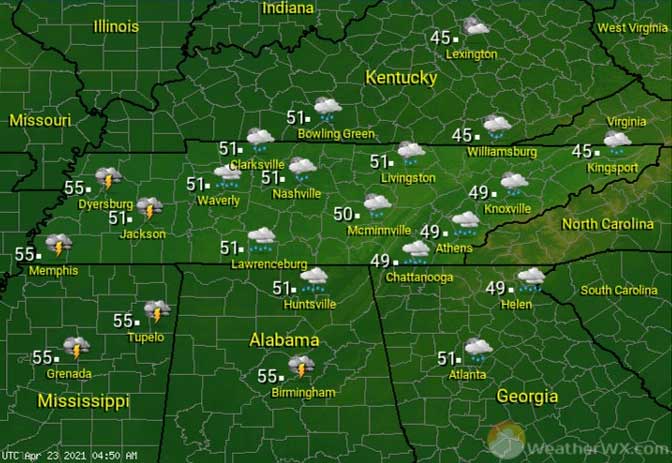
Showers are expected to overspread the state in the overnight hours. Any thunderstorms should be confined to the western end of the state. It will be a mild night. Overnight lows will only fall into the 50s for most, with lows in the mid to upper 40s for East Tennessee.
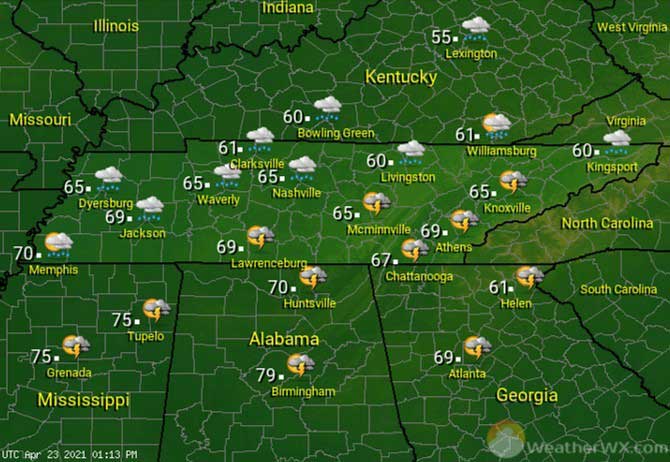
The weekend is off to a wet start, with rain and thunderstorms likely across the state. Thankfully, severe weather is expected to stay south of Tennessee, though a few strong storms may be found near the Alabama and Georgia border. Small hail and gusty winds would be the main threats with those storms. Thunderstorms should end from west to east during the day, leaving behind scattered rain showers in their wake. These April showers will be warm ones, with highs in the 60s statewide.
Visit Meteorologist Mark Baldwin on Twitter, Facebook and at meteorologistmark.com.