
Weather Images created by WeatherWX.com
Published July 27, 2021
By Meteorologist Mark Baldwin –
It’s a hot and humid Tuesday in Tennessee! Look for afternoon highs to top out around 90 degrees statewide. A few of us will dodge a shower or storm today, as there is about a 30% chance for a heat-of-the-day shower or thunderstorm.
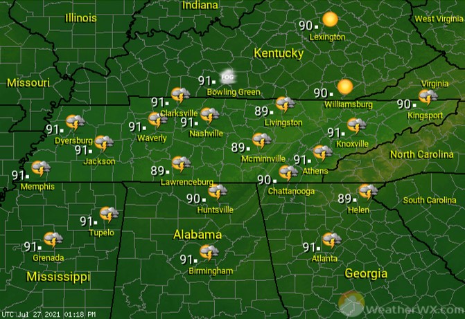
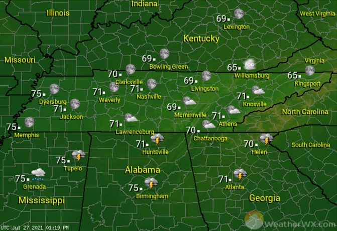
Skies should be clear to partly cloudy overnight. Muggy overnight lows will range from the mid 70s across the western end of the date, to the mid 60s across the eastern end of the state.
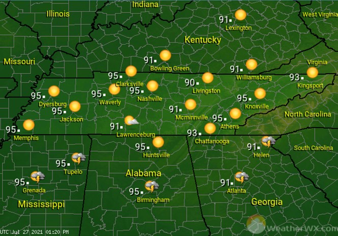
We’re in for a scorcher on Wednesday and this time any relief from a shower or storm looks very unlikely. Be safe in that heat! Afternoon highs will top out in the low to mid 90s, with our cities likely reaching 95 degrees.
Visit Meteorologist Mark Baldwin on Twitter, Facebook and at meteorologistmark.com.